GOES East & West
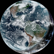
Data from the Geostationary Operational Environmental Satellites (GOES) available from NSF Unidata include 16 wavelength channels for GOES-R (e.g., later than GOES-16) class satellites. Data from both GOES-East and GOES-West satellites are available.
Data Capabilities
| Remote Data Access | Data Coverage | Display & Analysis Options | |||||||||
|---|---|---|---|---|---|---|---|---|---|---|---|
| LDM Feedtype1 | McIDAS ADDE | TDS | Short-Term Archive | Regional | National | Hemispheric | Global | GEMPAK | IDV | McIDAS | AWIPS |
| UNIWISC (FT5, MCIDAS) | ✓ | ✓ | ✓ | ✓ | ✓ | ✓ | ✓ | ✓ | ✓ | ✓ | |
| NIMAGE (FT21, IMAGE)2 | ✓ | East — West | East — West | ✓ | ✓ | ✓ | ✓ | ✓ | ✓ | ✓ | |
| SATELLITE (FT16, DIFAX)3 | ✓ | East — West | East — West | ✓ | ✓ | ✓ | ✓ | ✓ | ✓ | ||
1 See a complete list of LDM feed types
2 The NIMAGE feed type (FT21) was enhanced to include NOAAPort GOES-R/S ABI imagery and other Level2 products in June, 2019
3 The SATELLITE feed type (FT16) is named DIFAX in LDM v6.13.6 and previous
Ancillary Data Description
-
Geostationary Satellite Server
Description

The National Environmental Satellite, Data, and Information Service (NESDIS/NOAA) provides GOES data information on their Geostationary Satellite Server.
-
Data Center
Description
GOES satellite data information available at the Space Science and Engineering Center (SSEC) Data Center at the University of Wisconsin, Madison.
Questions About GOES East & West Data?
Questions or comments about GOES East & West data can be sent to: support@unidata.ucar.edu.