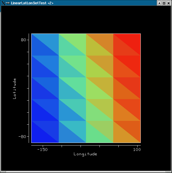
Thanks for your prompt reply, Bill. I modified the code to change the
longitude range and disable the texture mapping. The results are still
not what I expect. Can you shed any light on what I'm doing wrong?
    latitude = RealType.Latitude;
    longitude = RealType.Longitude;
    domain_tuple = new RealTupleType(latitude, longitude);

    int NCOLS = 5;
    int NROWS = 6;

    domain_set = new LinearLatLonSet(domain_tuple, -90.0, 90.0, NROWS,
                                               -180, 108.0, NCOLS);
    dispGMC.setTextureEnable(false);


-- john


Bill Hibbard wrote:
Hi John,

The image attached to your email is displayed using texture
mapping, so interpolation is not used. Also, your lower and
upper longitude bounds (-180 and +180) are "equal", so there
would be no meaningful interpolation between them anyway.
LinearLatLonSet is only useful if your application is using
interpolation and you have a truly "circular" longitude
sampling (say every 5 degrees from -177.5 to +177.5). Sorry
to say I don't know of an example using LinearLatLonSet.

Good luck,
Bill

On Wed, 14 Jul 2004, John C Cartwright wrote:
Hello All,

I'm trying to employ the LinearLatLonSet to take advantage of the
longitude "wrapping".  Can someone provide me an example of how to
properly use this?  Although I can get an image, it's not clear to me
that any interpolation is occurring across the longitude boundary. Test
case is based on example P3_2 in the tutorial and salient parts of the
code are listed below.


    int NCOLS = 5;
    int NROWS = 6;

    latitude = RealType.Latitude;
    longitude = RealType.Longitude;
    domain_tuple = new RealTupleType(latitude, longitude);

    domain_set = new LinearLatLonSet(domain_tuple, -90.0, 90.0, NROWS,
                                               -180, 180.0, NCOLS);


Thanks for your help!

-- john

====================================================
John Cartwright
Associate Scientist
Geospatial Data Services Group
CIRES, National Geophysical Data Center/NOAA
(303) 497-6284
John.C.Cartwright@xxxxxxxx
====================================================
--
====================================================
John Cartwright
Associate Scientist
Geospatial Data Services Group
CIRES, National Geophysical Data Center/NOAA
(303) 497-6284
John.C.Cartwright@xxxxxxxx
====================================================