Attached are a sample data file and a screen capture showing what was done. I used the transect instructions at
https://www.unavco.org/software/visualization/idv/IDV_for_GEON_howto.html#transvwhich are more complete than the transect instructions in the IDV user Guide.
Stuart Wier

(for Yomara Ma. Zúñiga Campos)
Attachment:
no-points-in-transect.png
Description: PNG image
(index) -> (Time,Latitude,Longitude,Altitude,magnitude,strike,dip,rake)
Time[fmt="yyyy-MM-dd
HH:mm:ss"],Latitude[unit="degrees_north"],Longitude[unit="degrees_east"],Altitude[unit="km"],magnitude[unit="null"],strike[unit="null"],dip[unit="null"],rake[unit="null"]
01-01-01 00:00:00,10.21,-84.28,-95.8,5.8,15,15,179
01-01-01 00:00:01,10.63,-86.6,-33.9,5.7,307,27,91
01-01-01 00:00:02,9.82,-85.76,-31,5.4,302,27,86
01-01-01 00:00:03,10.01,-84.31,-85.3,6,131,57,14
01-01-01 00:00:04,7.51,-82.68,-33,7.4,180,75,-159
01-01-01 00:00:05,10.319,-84.103,-88,5.9,279,80,-90
01-01-01 00:00:06,10.61,-86.01,-50,5.3,221,80,-53
01-01-01 00:00:07,8.24,-82.92,-32.2,5,119,86,0
idvusers archives: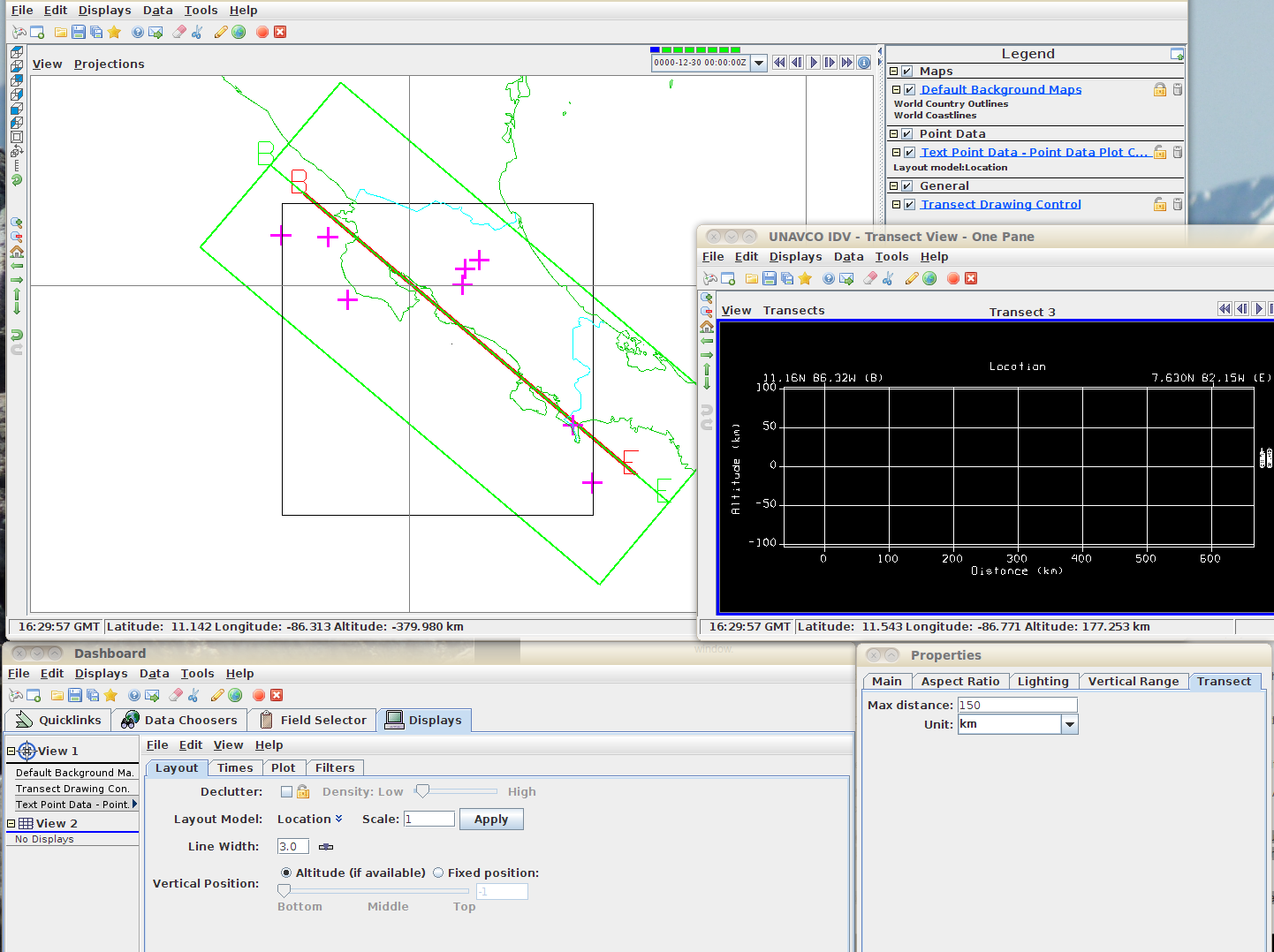