NOTE: The cf-satellite mailing list is no longer active. The list archives are made available for historical reasons.
Hi,


My name is Paul and I work at the National Snow and Ice Data Center. We
recently received some test swath data from NASA in .nc format. When I open the
data in Panoply and HDFView, it displays fine. However, when using ArcGIS,
QGIS, and GDAL, we are having trouble with the longitude. The data are
displaying exactly 180 degree difference from where it should be even though
the metadata in Panoply and HDFView are correct. It appears ArcGIS, QGIS, and
GDAL are using a 0 to 360 degree scale, rather than -180 to 180, and starts the
longitude at the International Date Line. Thus, when the files are read by
these tools, they are displayed incorrectly.


Have you seen anything like this in the past? The data providers are claiming
it’s the software and not the data but I would like to get your opinion.
Unfortunately, the files are rather large so I cannot email but have attached a
screenshot. The .nc file should be over Japan but appears over the Atlantic.


Thanks,

Paul Moth
User Services Office
National Snow and Ice Data Center
University of Colorado at Boulder
Attachment:
Screen Shot 2017-06-07 at 10.43.06 AM.png
Description: PNG image
cf-satellite archives: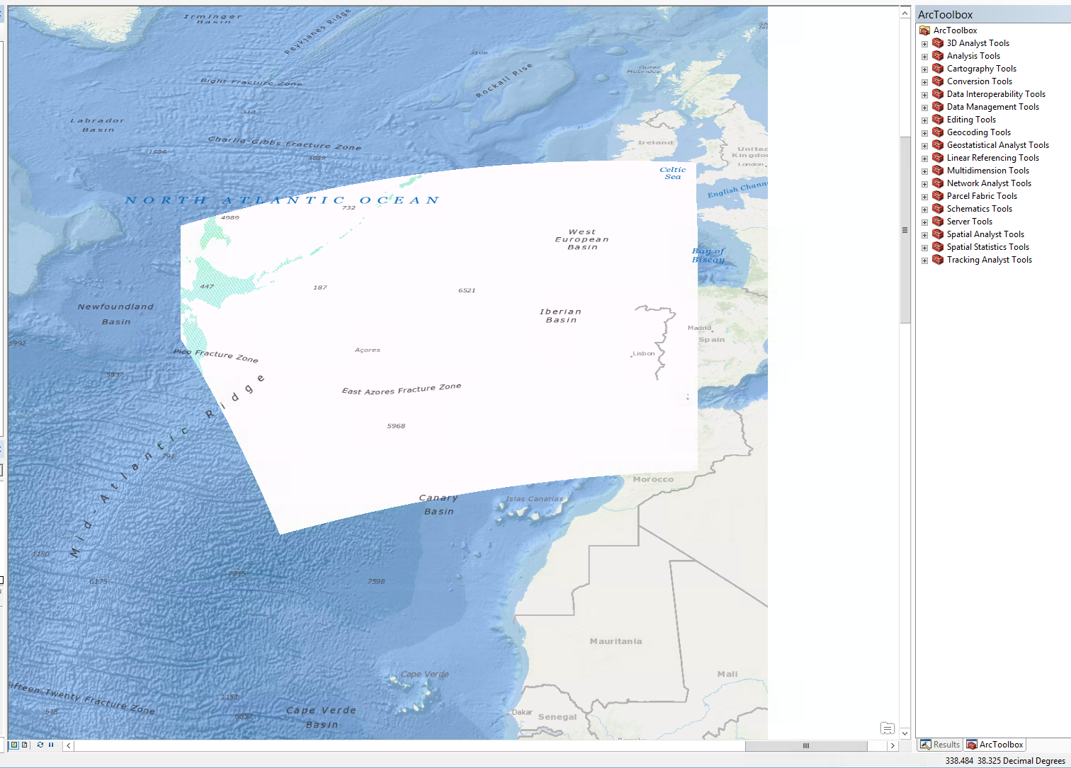