GEMPAK/NAWIPS
Status Report: October 2013 to April 2014
Michael James
Strategic Focus Areas
GEMPAK supports the following goals described in Unidata Strategic Plan:
-
Enable widespread, efficient access to geoscience data
GEMPAK remains widely used among academics, researchers and students as a way to visualize meteorological data in a package used by a number of operational forecasters. New data formats continue to be added and support for existing formats continues to improve. -
Develop and provide open-source tools for effective use of geoscience data
GEMPAK is and always will be open-source. -
Build, support, and advocate for the diverse geoscience community
GEMPAK continues to support new data formats, and Unidata continues to focus on training and documentation to bring in more of the university and research community. Scatterometer data visualization, for example, is being improved to prepared for use by marine forecasters from tje India Meteorological Department. A training workshop in Hyderabad, India is in the preliminary planning stage.
Activities Since the Last Status Report
GEMPAK7 Release
-
GEMPAK7 was released in March 2014 and incorporates a number of the changes mentioned here.
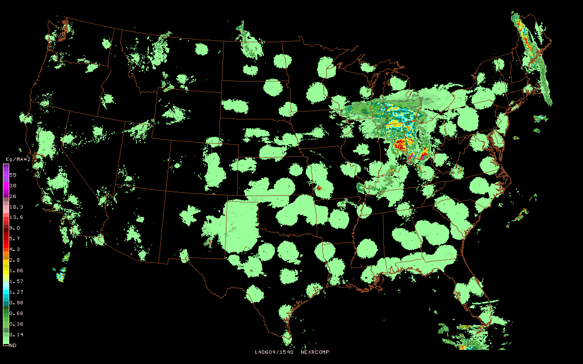
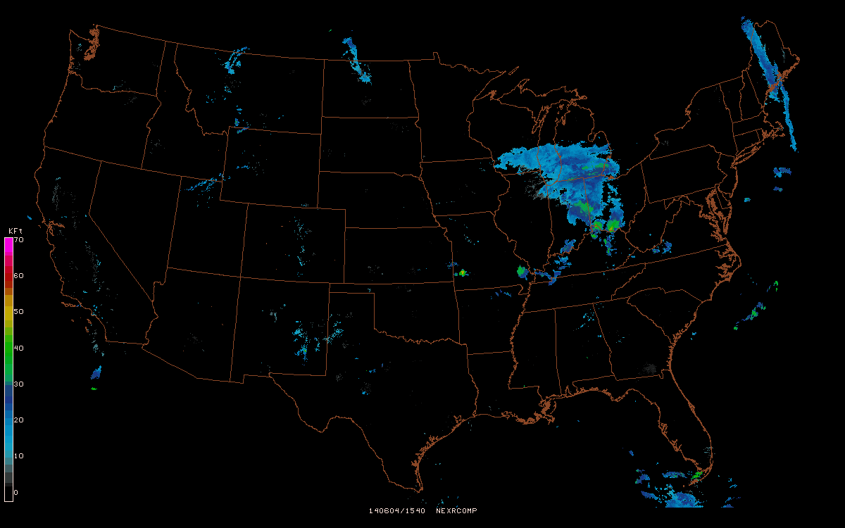
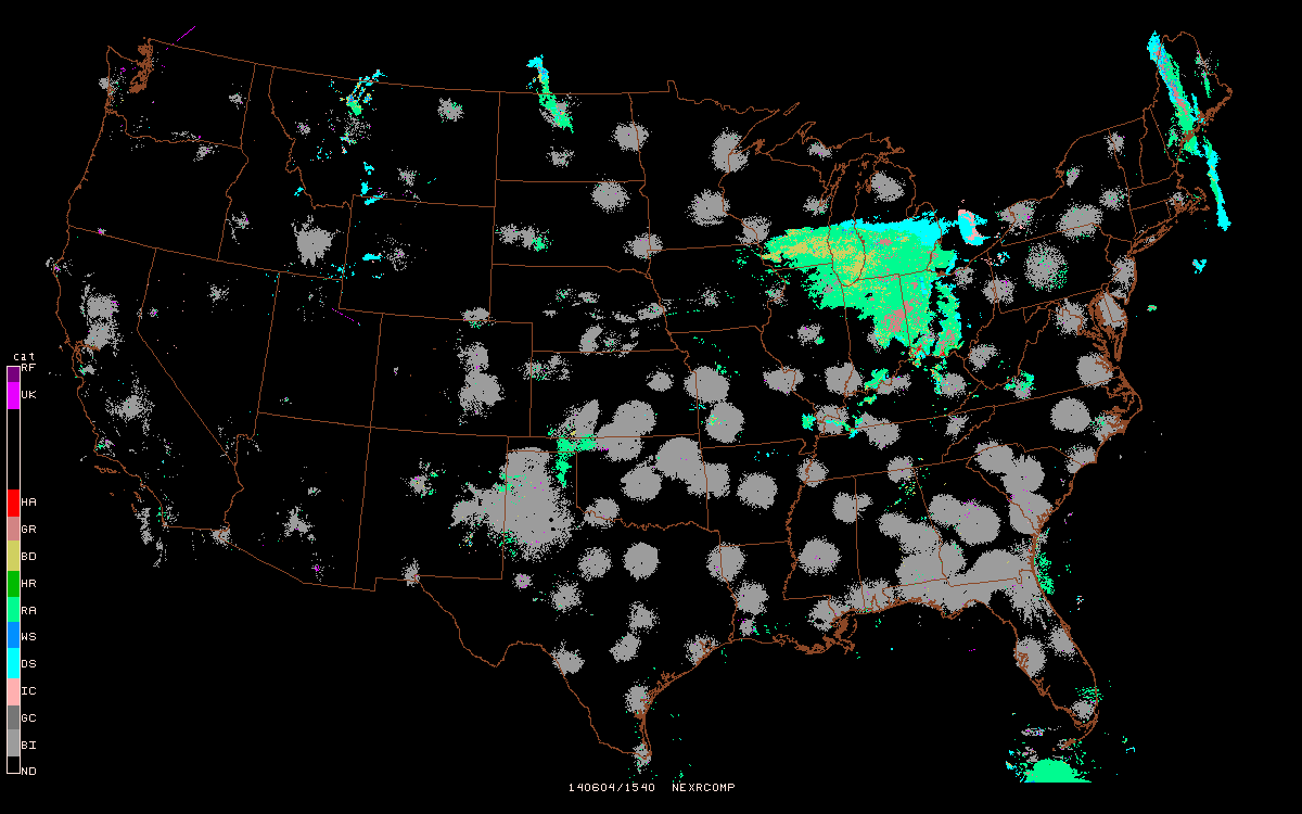
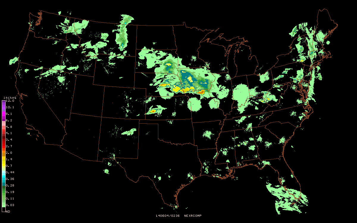
RADAR DATA
-
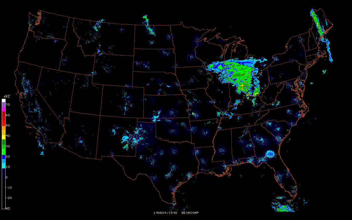
NEX2GINI was re-tooled to better support generation of high-resolution NEXRAD composites such as DHR Digital Hybrid Reflectivity, DVL Digital Vertically Integrated Liquid, EET Enhanced Echo Tops, HHC Hybrid Hydrometeor Classification. Unidata is now generating a number of high-res composites in addition to the 4-bit legacy products such as N0R, N1P and NTP. The national composite GINI images will be made operational (available via the LDM/IDD) in March 2014, with product genesis taking place on our ec-2 Amazon Cloud Computing instance.
-
GPNIDS support added for FNEXRAD product aliases, using
%SITE%as resolution (1km|2km|4km)NEXRIII $RAD/NIDS/%SITE%/%PROD% %PROD%_YYYYMMDD_HHNN NEXRCOMP $NEXCOMP/%SITE%/%PROD% %PROD%_YYYYMMDD_HHNN -
Added Python decoder to convert AWIPS II colormaps to GEMPAK lutfils.
-
Level 2 and Level 3 graphical product color schemes updated to conform to AWIPS/AWIPS II standards.
SCATTEROMETER DATA
-
New program GPSCAT to plot scatterometer Significant Wave Height and Ocean Wind Vector data.
-
Preliminary data feeds for ASCT_HI and SGWH2 relayed through CPTEC/INPE, while new OSCT_HI data feed secured through agreement with NESDIS for use by international agencies and future Marine Forecasting Workshops.
- ASCT_HI

- OSCT_HI
- SGWH2

RIO and WRF-NMM
-
Region-Of-Interest (ROI) for the WRF-NMM uses the 30-hour 12km NAM precipitation forecast to objectively-select an area of maximum precipitation accumulation for use as a WRF domain. The final WRF files are converted to GEMPAK grid format, uploaded to our internal data mount, and used to create web products (both for the "floater" WRF and the "Colorado" WRF):
- Colorado WRF [Simulated Reflectivity], [Surface Precipitation], [Surface Temperature]
- Floater WRF [Simulated Reflectivity], [Surface Precipitation], [Surface Temperature]
OTHER ACTIVITIES
- GEMPAK7 released early 2014.
- GEMPAK7 support added for new SSEC satellite image products added to the IDD. A Python script is written which creates imgtyp.tbl GEMPAK table entries for McIDAS AREA files.
- GEMPAK7 includes binary packaes for 32- and 64-bit Linux, x86 SunOS, and Mac OS X 10.9 Mavericks.
- Template handling error fixed for HHC, problem where the hour signifier "HH" in (YYYYMMDD_HHNN) conflicted with product identifier.
- OPC lightning strike density grids supported.
- Build for SunOS machines significantly re-worked and improved.
- Added HRRR grib tables (courtesy K.Tyle, UAlbany)
arinfonow reports sector source number.- Added
_pngdirect device forgdplot2 - Fixed
dcsuomi,dcnctrop,dccosmicanddcacarsbug which would leave empty temporary netCDF files in ~ldm - Fix for NEX2GINI grid generation which overlayed lower Echo Top (topped) values over higher (untopped) values, resulting in "holes" in data coverage over radar sites.
- Due to security issues, web-cgi GEMPAK manual pages were replaced by statically-generated pages created by C-shell script.