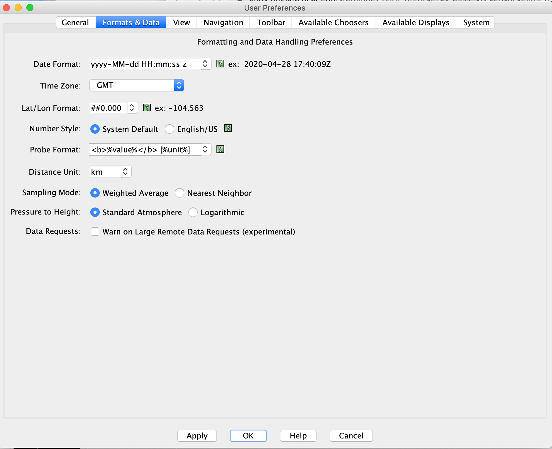
> Dear Unidata:
>
> IDV is a great tool for viewing and analyzing satellite data.  I commonly use
> it to display and mark volcanic ash clouds using the Drawing Tool.  When I
> try to write the lat/lon coordinates of a polygon to a .csv file  however, I
> notice that the coordinates are written to only a precision of 0.1 degrees.
> The screenshot below illustrates the problem.
>
> [cid:797eb649-6673-4de5-b94e-1ff4ea6a184f]
>
> Is there an easy way to increase the precision of the coordinates when
> writing them out?
>
> Thanks,
>
> Larry Mastin
>
> U.S. Geological Survey
> David A. Johnston Cascades Volcano Observatory
> 1300 SE Cardinal Court, Bldg. 10, Suite 100
> Vancouver, WA 98683
> tel (360) 993-8925
> fax (360) 993-8980
> ORC ID 0000-0002-4795-1992<https://orcid.org/0000-0002-4795-1992>
> https://www.usgs.gov/staff-profiles/larry-mastin<https://www.usgs.gov/staff-profiles/larry-mastin?qt-staff_profile_science_products=6#qt-staff_profile_science_products>
>
>

You can increase the precision by changing the preference:

Edit > Preferences, and Format & Data, you can increase the precision there.

Yuan


Ticket Details
===================
Ticket ID: YUS-648572
Department: Support IDV
Priority: Normal
Status: Open
===================
NOTE: All email exchanges with Unidata User Support are recorded in the Unidata
inquiry tracking system and then made publicly available through the web.  If
you do not want to have your interactions made available in this way, you must
let us know in each email you send to us.
Attachment:
Screen Shot 2020-04-28 at 11.41.22 AM.png
Description: PNG image