The NSF NCAR Education, Engagement & Early-Career Development (EdEC) program's Advanced Study Program (ASP) Summer Colloquium takes place July 13–24, 2026 in Boulder, CO. Applications are due by February 22, 2026.
NSF NCAR's Computational and Informations Systems Lab makes high performance computing resources available to university researchers and educators. The next deadline for large allocation requests is March 4, 2026.
A reminder that the 2026 NSF Unidata Community Equipment Awards solicitation is open until March 27, 2026. Created under the sponsorship of the U.S. National Science Foundation, NSF Unidata equipment awards are intended to encourage new members from diverse disciplinary backgrounds in the Earth Systems Sciences to join the NSF Unidata community, and to encourage existing members to continue their active participation, enhancing the community process. For 2026, a total of $100,000 is available for awards; proposals for amounts up to $20,000 will be considered.
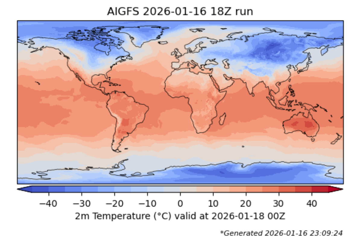
In partnership with the NOAA/NWS National Centers for Environmental Prediction (NCEP) through the Cooperative Opportunity for NCEP Data Using IDD Technology (CONDUIT) program, the NSF Unidata Program Center is pleased to announce the availability of artificial intelligence (AI)-driven global weather prediction model output in NSF Unidata datastreams.
NFS Unidata will be updating the underlying server technology for our Maven artifacts server (artifacts.unidata.ucar.edu) on Tuesday, January 20th, around 12:00 MST (UTC-7). While internal testing using both Maven and Gradle indicates that the transition should be transparent, users are encouraged to reach out to support if they encounter any issues.