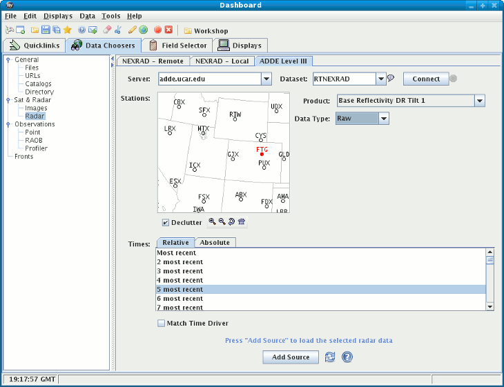
Previous: An Animation Loop of Satellite Imagery Next: Level II Radar Table of contents Images Frames Unidata's Integrated Data Viewer > Getting Started

2.1 An Animation Loop of NWS WSR-88D Level III Radar Imagery
This section describes how to make a display using Level III radar data.
images/Level3Display.gif
The steps include:
2.1.0  Choosing Radar Image Data from a Remote Server
2.1.1  Selecting the Radar display to be made
2.1.0 Choosing Radar Image Data from a Remote Server
In the Dashboard window select the Data Chooser tab. From here select the Radar tab to view the Level III Radar Chooser:
../data/choosers/images/Level3Chooser.gif
  1. Choose an ADDE Server and a Dataset to use:
    Try Server: adde.ucar.edu and Dataset: RTNEXRAD.

  2. Press 
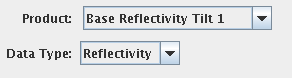
Connect to query the server for available radars types:

  3. The map shows radar station locations and IDs. Select one by clicking on it.
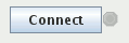
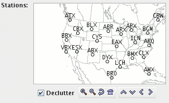
    The Declutter check box allows you to show all stations (not checked), or only a limited number of stations that do not overlap each other (checked). You will need to zoom in to see all the stations without overlaps.

  4. For the Radar Data Type of data from this radar, select a radar product, such as Base Reflectivity Tilt 1, from the pull-down menu.

  5. Either, choose a relative set of times steps (e.g., Last 5 times):

  6. Or, choose a set of absolute times:
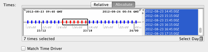
    When choosing absolute times for the first time the IDV needs to query the ADDE server for the times. This may take some time. To select more than one time use Control-Click or Shift-Click.

  7. When done, load the selected radar data with the Add Source button.
    If the Create display button is selected then a radar display will automatically be created

2.1.1 Selecting the Radar display to be made
The radar data source that you selected will be shown in the Field Selector window.
images/RadarSelector.gif
If you checked off the 
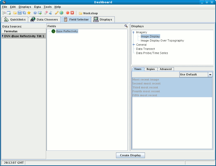
Create display button or if you want to create another radar display click "Image Sequence" in the Field panel and click on "Image display" in the Displays panel. Make the display by clicking on Create Display.

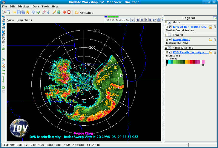
You can add Radar Range Rings to the display. To control time animation use the Time Animation Widget.

Example
Click to launch via webstart Click to launch via webstart


Previous: An Animation Loop of Satellite Imagery Next: Level II Radar Table of contents Images Frames Unidata's Integrated Data Viewer > Getting Started