


 Unidata's Integrated Data Viewer > Dashboard > Choosing Data Sources

3.4.2 Choose Cataloged Data
The Catalogs chooser shows THREDDS catalogs of data holdings
on remote data servers (typically TDS or OPeNDAP)
and provides access to remote Web Map Server (WMS) image servers.
The IDV provides an initial default catalog, idvcatalog.xml. It should appear
in the Catalogs menu. If not you can directly enter the URL of the catalog:
https://resources.unidata.ucar.edu/georesources/idvcatalog.xml
This catalog has links to a catalog of real time model data, a collection
of county level shapefiles for roads and hydrography features and a collection
of useful Web Map Servers.
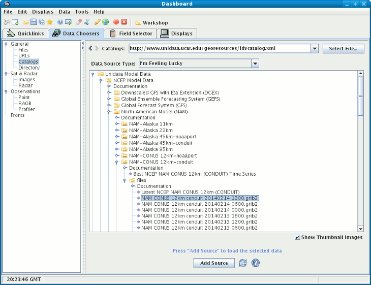 Image 1: Catalog Chooser
- In the entry box enter the catalog URL (and press
) or select a catalog URL from the pull down list.
You can use the button to select a catalog on
your local disk.
- Navigate through the tree view to the desired data source.
- Catalogs may show absolute or relative times. See below
for more information.
- Select a data source by clicking on the particular data
desired (e.g., "NCEP NAM 80km CONUS 2004-07-21 12:00:00 GMT"
under "NCEP NAM 80km CONUS model data")
- When done, load the selected data with the button.
- Some catalogs contain documentation (shown under the "Documentation"
nodes). You can mouse over the nodes or double click
them to view the documentation.
Catalogs may list both absolute time model runs
(e.g., "NCEP NAM 80km CONUS 2004-07-21 12:00:00 GMT"
as well as relative time
(e.g., "Latest NCEP GFS...").
You can choose to load the most recent data for each of these groups
of data. When you do this the IDV will query the remote server to determine
what actual model run is the latest data. The IDV will use that particular
model throughout the entire session. However, if you save the
state of the application (using the bundles
facility) then when the state is loaded back in the IDV will again determine
what is the actual latest data and use that data set.
The following image displays the WMS chooser:
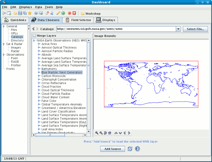 Image 2: WMS Chooser
Unidata's Integrated Data Viewer > Dashboard > Choosing Data Sources