[
Date Prev][
Date Next][
Thread Prev][
Thread Next][
Date Index][
Thread Index]
[no subject]
- Date: Wed, 15 Dec 2004 10:47:57 -0700
Hi Russ,
> Words of wisdom ... from me !!!???!!!
Yea, well it was a reach ;-)
> What you are describing is referred to as the "bow tie effect". It
>is an artifact of the scanning geometry of the MODIS instrument. The
>conical scanner oversamples pixels on the outer edges of each sweep. The
>result is multiple pixels for the same Earth location from different
>angles.
I knew that there was a better term for what I was trying to describe.
> The good news is that we have code to correct this effect. The
>correction is applied during a remap of the MODIS L1B images into
>another projection.
Only the L1B images? What about for images from things like the
NASA server (nanuk.eosdis.nasa.gov)?
>The bad news is, we haven't implemented it yet. The
>code needs to be inserted into the LALO navigation package. It will
>require some sort of switch to recognize that the correction needs to be
>applied. Dave tells me that this work will probably require about 1
>weeks effort to implement.
OK.
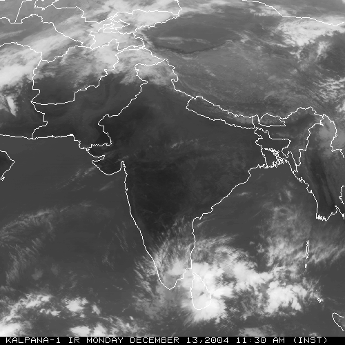
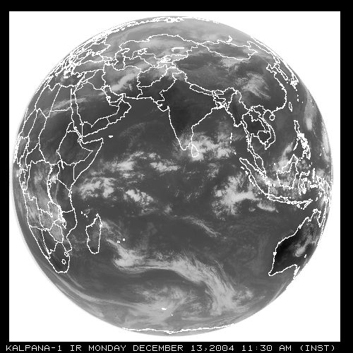
> On another subject, here are some loops of images from Kalpana-1
>(Indian GEO satellite). We are working on adding this satellite to our
>GEO set.
>http://www.ssec.wisc.edu/~daves/KALPINDIA.gif
>http://www.ssec.wisc.edu/~daves/KALPFD.gif
Very cool. Is SSEC getting the data in realtime?
> We also have new ADDE servers for the MODIS SST (Mod28) and
>Aerosol (Mod04) products.
Excellent. When do they hit an addendum?
Cheers,
Tom
--
NOTE: All email exchanges with Unidata User Support are recorded in the
Unidata inquiry tracking system and then made publicly available
through the web. If you do not want to have your interactions made
available in this way, you must let us know in each email you send to us.
>From address@hidden Wed Dec 15 11:27:29 2004
re: MODIS bowtie effect, Only the L1B images?
All L1b MODIS images will have this problem. Any MODIS image that
doesn't show the bow tie effect has been "rectified" in some way. The
image projection may stay the same, but the edges have been massaged.
re: bowtie rectification work schedule
This will probably be implemented in early 2005.
re: are images from Indian satellite in realtime
No. Jerry ftp's these once a day. We use IMGMAKE to convert them to
McIDAS AREAs. These images have a bad problem with navigation (ie. there
isn't any). We had to hack a Meteosat image navigation to get it as
close as it is now, but its not very good. We are attempting to refine
the navigation using landmarks (McIDAS auto-navigation).
re: new ADDE servers for the MODIS SST (Mod28) and >>Aerosol (Mod04) products.
SST and AER servers will probably go out it the next release. If
you're interested, I can ask Kathy Strabala if she has these available
to grab (via ADDE).
Russ